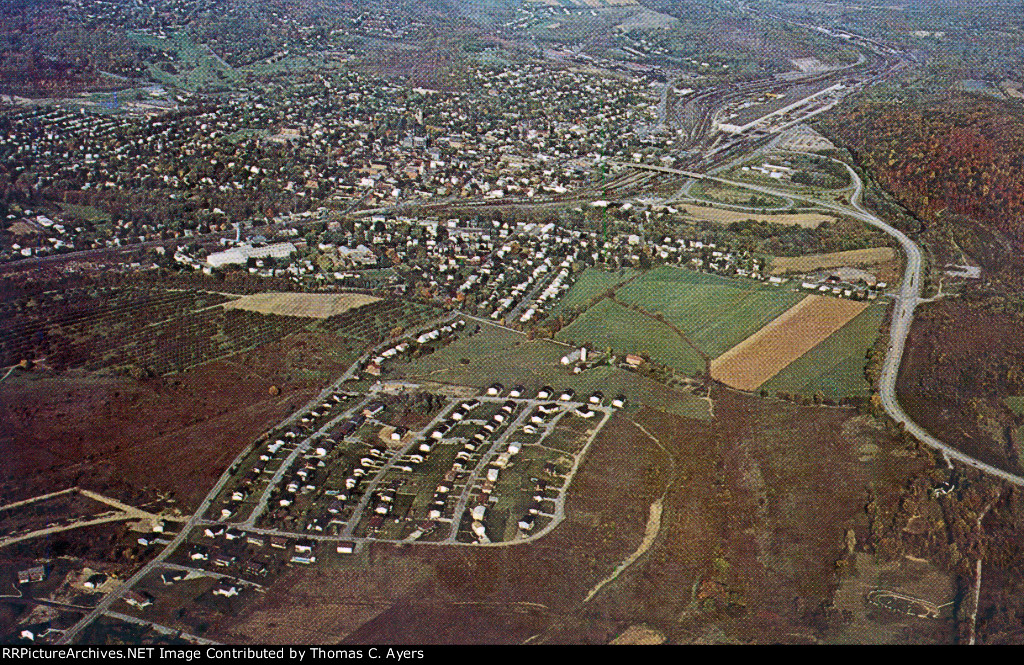
| Personal PC. Here is a postal card that could be entitled "Aerial View of Hollidaysburg, Pennsylvania." Photo by Joseph R. Nedimyer. No Postmark. Visible at the upper right is the Samuel Rea Shop and its supporting railroad yards. Bracketing them are the rail lines leading East to Frankstown and Petersburg (to the right), and West to Duncansville and Gallitzin (to the left). The highway at the right is US Route 36: North toward Altoona to the left and South toward Bedford at the right. |
| Date:
8/15/1968 |
Location:
Hollidaysburg, PA Map  |
Views:
52 |
Collection Of:
  Thomas C. Ayers
 |
|
Author: Thomas C. Ayers
|
 |
| Picture Categories: Bridge,Yard,Track |
This picture is part of album: USA: The Ayers Postal Cards |